REVIEW · BOSTON
Building Blocks of Boston : Downtown Walking Tour
Book on Viator →Operated by Behold Boston Tours · Bookable on Viator
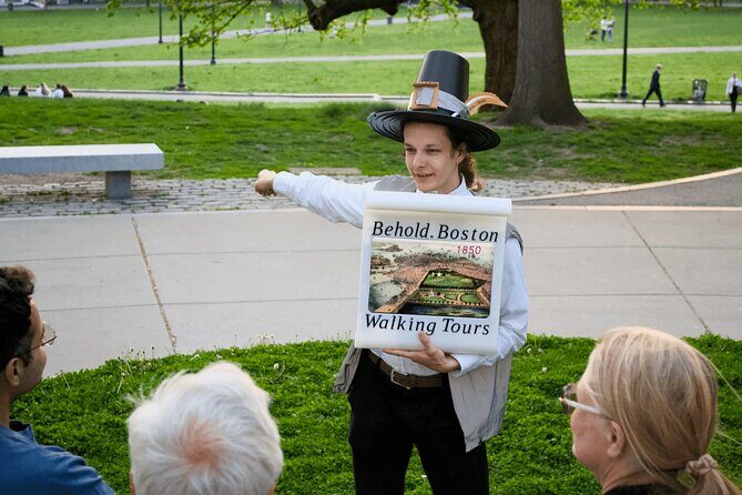
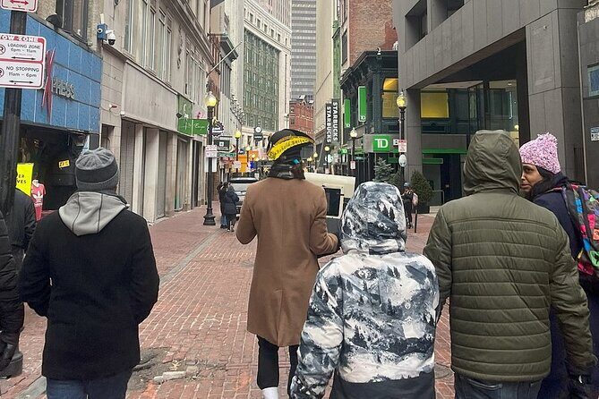
Boston history walks by, block after block. This downtown walking tour is built to help you see how Boston changed, fast, with an expert guide and an UltraHD display that brings key scenes to life. I especially like the way the stories connect different eras in a small area, and the UltraHD scroll with restored photos, movies, and sounds that makes the past feel specific instead of vague. One thing to plan for: this tour really depends on good weather, so you’ll want a flexible day.
At a price of $29.40, it’s a solid value if you enjoy guided context while you walk. The group size is capped at 16, and you get a short break with restrooms and AC, which matters when you’re doing a concentrated city loop. If you hate crowds or want long, slow museum-style time at each stop, you may find the pace brisk.
In This Review
- Key things I’d watch for
- A 2-hour downtown route that actually makes sense
- Boston Common to the Soldiers and Sailors view: the city’s start point
- Boston Common: the birth of Boston
- Boston Soldiers and Sailors Monument: civil war symbolism and a skyline peek
- Back Bay, when it was a bay
- The Embrace and Park Street Church: civil rights and transit history in one corridor
- The Embrace: MLK’s Boston connection
- Park Street Church: former tallest, first subway, busy street
- Downtown Crossing and Winthrop Square: fires, ideas, and city momentum
- Downtown Crossing: the Burnt District story
- Winthrop Square: a short break with fountains and the Great Hall
- South Station to Old State House: transportation change and a 300-year time capsule
- South Station: how Boston moved people over time
- Post Office Square: cow paths, parking, and a little humor
- Old State House: the evolution of British symbols
- Price and value: why $29.40 can work (or not)
- Who this tour suits best
- Should you book Building Blocks of Boston: Downtown Walking Tour?
- FAQ
- How long is the Building Blocks of Boston Downtown Walking Tour?
- Where does the tour start and end?
- Is the tour offered in English?
- How large are the groups?
- Is there a restroom stop or a break?
- What happens if the weather is bad?
Key things I’d watch for
- UltraHD visuals at street level help you understand what you’re looking at, including before-and-after moments.
- A tight, logical route across downtown keeps you from wasting time figuring out where to go next.
- Real local symbolism at monuments like Boston’s civil war marker and MLK’s memorial story.
- A built-in comfort break with accessible restrooms and AC.
- Lots of transportation talk at South Station, tying railways, highways, tunnels, and boats into one story.
- Picture-friendly stops where your guide can help you frame shots as you go.
A 2-hour downtown route that actually makes sense
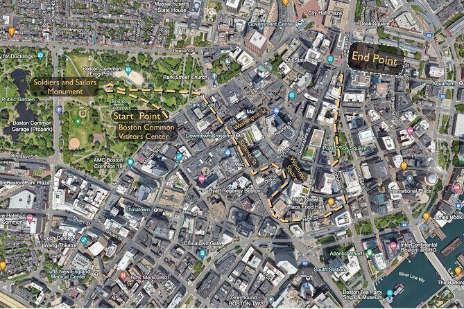
This tour is about 2 hours and 5 minutes of walking with stops scattered across the downtown core. It starts at 139 Tremont St and ends at 11 Congress St, so you finish in a different spot than where you began. That’s not a problem, but it does mean you’ll want to plan your day around the endpoint.
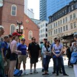
The pace is structured: you’ll hit eight major stops, with short time blocks at each location. A 10-minute break with accessible restrooms and AC is built in, which helps you stay comfortable instead of dragging through the hottest or coldest hours. The tour is offered in English, uses a mobile ticket, and keeps groups small with a maximum of 16 people, so the guide can keep the storytelling clear.
If you like history, street-level clues, and learning how the city reshaped itself over time, this format is a good fit. If you want deep research time at a single site, you might prefer a longer stop elsewhere—this one is for getting your bearings quickly and leaving with a connected mental map.
You can also read our reviews of more walking tours in Boston


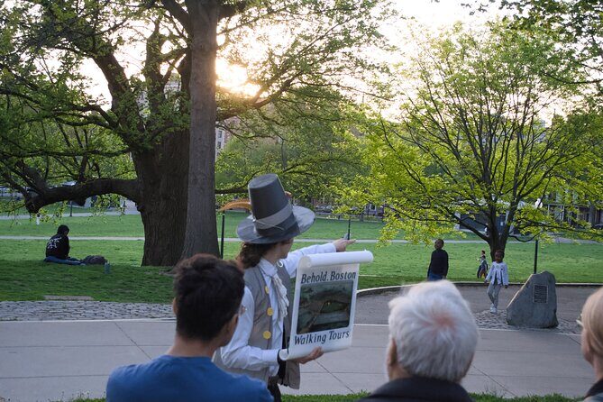
Boston Common to the Soldiers and Sailors view: the city’s start point
Boston Common: the birth of Boston
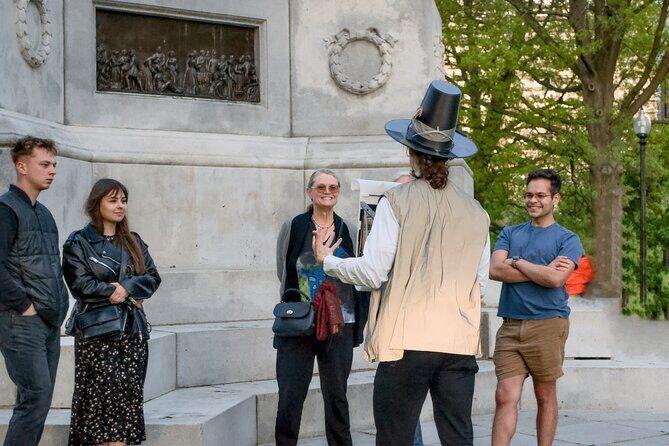
You begin at Boston Common, and the guide’s framing is simple: this land mattered early. You’re told to think of Boston as being born in 1630, with details about an Englishman who lived alone on the land starting in 1625, plus the bold person who sailed for 10 weeks through stormy seas to help seed the city. Even if you’ve read bits of early New England before, the tour’s goal here is to make those names feel tied to the streets you’ll walk later.
Boston Common can feel like a big open lawn if you arrive without context. With this tour, you get a story for why it’s not just green space—it’s a starting line for the city’s identity and authority.
Boston Soldiers and Sailors Monument: civil war symbolism and a skyline peek
Next comes the Boston Soldiers and Sailors Monument, built to honor the civil war. You’ll look at the symbols and reflect on how they connect back to the people who established Boston. The stop also pays off with an excellent view toward Back Bay, which helps you switch from early Boston to the next layer of the city’s evolution.
This is one of those stops that works even if you only catch part of the guide’s explanation—because the monument is visually strong, and the view gives you immediate payoff. If you’re camera-inclined, this is a good place to take a few photos before the route turns more street-and-staircase focused.
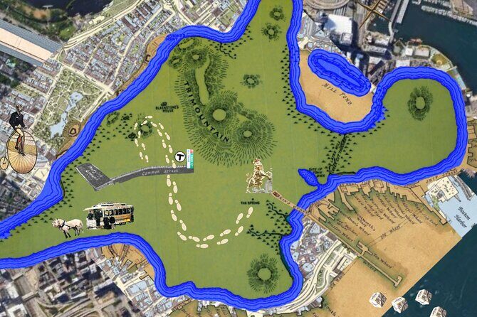
Back Bay, when it was a bay
Right after the viewpoint, the tour zooms into what Back Bay used to be: it was a bay, then it was filled in, and eventually a neighborhood for business and residents was built. That’s the kind of detail that changes how you see the entire city. Instead of assuming Boston’s neighborhoods just grew naturally, you realize how much deliberate engineering shaped where people lived and worked.
Even with only a short explanation, you’ll leave thinking about land, tides, and construction—because the city you walk through today was planned in part by making new ground.


The Embrace and Park Street Church: civil rights and transit history in one corridor
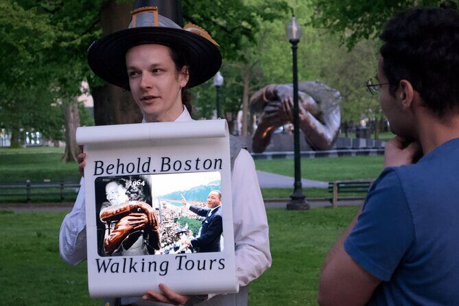
The Embrace: MLK’s Boston connection
At The Embrace, you get the story behind the sculpture commemorating MLK Jr. He met his wife, Coretta Scott, in Boston while studying at Boston University. This stop does more than point at art—it gives you a personal timeline, anchored to Boston rather than to a distant era you only know from books.
If you’ve seen MLK memorials elsewhere, the key difference here is how Boston is placed in the narrative. You’re not just learning about a national figure; you’re learning about a specific Boston chapter.
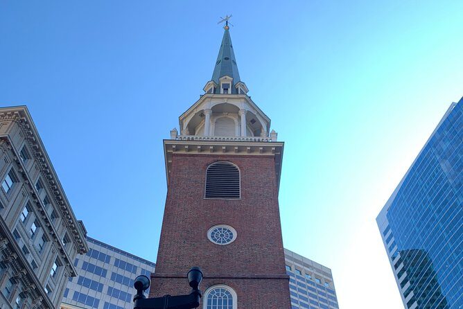
Park Street Church: former tallest, first subway, busy street
The next major stop brings you to Park Street Church. You’ll learn it was the former tallest building in America, and that it’s also the site of America’s first subway. On top of that, it sits on one of the busiest streets in Boston, so you experience the contrast instantly: old infrastructure signals meeting modern foot traffic.
This stop is ideal if you like your history to have physical consequences. The tour doesn’t treat Park Street like a postcard stop; it frames it as a gateway between eras—when the city started building underground ways to move people, long before today’s subway routines became normal.
Downtown Crossing and Winthrop Square: fires, ideas, and city momentum

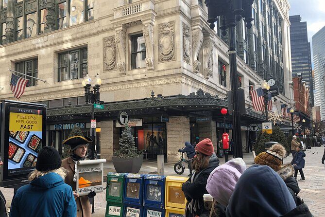
Downtown Crossing: the Burnt District story
At Downtown Crossing, you’re guided through the transformation of downtown across three separate centuries. You’ll also hear the story of the Burnt District, the name tied to a devastating fire.
That theme matters because downtown Boston can look like a blur of storefronts and traffic. The tour helps you see patterns—how destruction and rebuilding can redirect a whole commercial center. Even if you walk through it daily, you can start to recognize it as a place shaped by major events, not just “where people shop.”
If you’re the kind of person who likes to understand why a city’s layout feels the way it does, this is a strong stop. If you’re tired or the streets are crowded, just keep it simple: listen for the fire-and-rebuild storyline, then look at the surroundings with that lens.
Winthrop Square: a short break with fountains and the Great Hall
Next is Winthrop Square, where the tour includes a 10-minute break among fountains and the brand new Great Hall in the Winthrop Center. Breaks are not optional on this route—you’ll likely need them.
The walk here also includes discussion about education and writings that influenced Bostonians and the rest of the world. That’s a smart pairing: you rest your legs while your mind gets new anchors for how Boston’s “ideas” got exported.
This stop is where the tour feels especially practical. You get a real breather, plus context that doesn’t require you to sit in one place for a long time.
South Station to Old State House: transportation change and a 300-year time capsule
South Station: how Boston moved people over time
At South Station, the conversation shifts to transportation. You’ll see and hear about the transformation of how Boston handled movement—railways, highways, tunnels, and boats tied to the waterfront area. The tour also explains what happened to the connection between Boston’s North and South Station.
This is one of those stops where the history comes with consequences you can feel. South Station isn’t just a building you pass; it’s a physical outcome of decisions about where traffic should go, how fast it should move, and how the city links different areas.
You’ll also learn about Charlie from the subway cards. Even if you’re not a transit-history nerd, that detail helps you connect the guide’s story to how modern people actually experience the system.
Post Office Square: cow paths, parking, and a little humor
Then you reach Post Office Square, where the tour asks big questions in small ways. You’ll be told to consider whether Boston’s streets were once cow paths, and why parking is so expensive in this part of town. Then there’s a playful bit: you’ll be doing the crowd-dependent wordplay of whether it’s horse around or morse around.
That blend—geography, cost, and humor—keeps the tour from turning into lectures. It also gives you a quick way to remember the area. If you’ve ever wondered why certain streets feel older than the buildings around them, this stop gives you a plausible narrative frame to carry onward.
Old State House: the evolution of British symbols
Finally, you end at Old State House, described as Boston’s brightest time capsule. It’s also the oldest public building in Massachusetts, and you’ll learn about the removal and replica of British symbols atop the building as it evolved across about 300 years.
This is a powerful closing note because it ties to identity. The building becomes the story of political change written into architecture. As you look at it, the earlier stops start to click too—how Boston kept reinventing itself, whether through land fill for Back Bay, the reshaping of downtown after fire, or the redesign of how people move at rail hubs.
If you want a tour that ends with a clear, memorable concept, this one does that.
Price and value: why $29.40 can work (or not)
$29.40 is not “cheap,” but it’s also not museum-priced. For the money, you’re paying for an expert guide, plus that UltraHD scroll with restored photographs, movies, and sounds. You’re also paying for a route that keeps you from having to plan stop-by-stop yourself across downtown.
Here’s how I think about value for this specific tour:
- If you want a guided overview of major downtown sites with context, the cost is easier to justify. The guide’s job is to connect details so the city becomes legible.
- If you’re more of a do-it-yourself explorer, you may find the price harder to swallow unless you truly enjoy listening to explanations while walking.
- The good part: the tour time is short enough that you’re not spending half a day on your feet. For many people, that makes this an efficient “history reset.”
One practical consideration: because the tour is weather-dependent, you’ll want to check forecasts. If conditions are poor, the tour will be adjusted or refunded, but your best outcome comes from picking a day that stays walkable.
Who this tour suits best
This is a strong choice for you if you want:
- A compact downtown route where history is tied to what you can see
- A guide who explains symbols and connects them to Boston’s growth
- UltraHD visuals that support what’s happening on the street
- A small group feel (max 16) instead of a huge crowd shuffle
It’s also a good pick if you’re doing Boston for the first time and want to leave knowing how early settlement, civil war memory, civil rights memorial art, transit history, and political symbolism fit together.
If you already know Boston deeply and crave long, single-site time, this may feel too short. But if your goal is orientation plus meaning, it’s a very workable pace.
Should you book Building Blocks of Boston: Downtown Walking Tour?
I’d book it if you like learning while walking and you want a guided “connect-the-dots” overview of downtown Boston. The UltraHD visual support and the careful stop selection make the tour feel purposeful, not random. The built-in break with restrooms and AC is also a real quality-of-life win on a street-level loop.
I’d think twice if you hate visual aids, dislike group tours, or need lots of time sitting and reading at each location. In that case, you might prefer a self-paced route with longer time at fewer stops.
FAQ
How long is the Building Blocks of Boston Downtown Walking Tour?
It lasts about 2 hours and 5 minutes.
Where does the tour start and end?
It starts at 139 Tremont St, Boston, MA 02111 and ends at 11 Congress St, Boston, MA 02109.
Is the tour offered in English?
Yes. The tour is offered in English.
How large are the groups?
The tour has a maximum of 16 travelers.
Is there a restroom stop or a break?
Yes. The itinerary includes a 10-minute break with accessible restrooms and AC.
What happens if the weather is bad?
The tour requires good weather. If it’s canceled due to poor weather, you’ll be offered a different date or a full refund.